I had hopes of getting a really early start this morning; if I did, maybe I could make it all the way down to the 3-mile rest house on Bright Angel Trail (meaning, of course, a 6-mile round-trip hike) and still be up and out of the canyon by 10:00! However, I opted to just wake up when I woke up, rather than setting an alarm, since the only alarm available to me was via my iPhone, which was out of juice and which I didn’t want to charge off of my C-PAP battery, for fear of draining the latter down too much. (I’d had my phone turned off pretty much since the afternoon of my first day out here, due to its lacking power and to the fact that the wifi at the store & etc. proved very unreliable in any case). So, anyway, not surprisingly, I ended up sleeping somewhat later than I’d hoped to, and by the time I was up and dressed, had replenished the ice in my cooler, and had made my way via bus to the Bright Angel Trailhead, it was just after 7:00. I knew this meant that I wouldn’t be making it to the 3-mile rest house today, but I’d at least get as far as the 1.5-mile one, and see from there. Initially, I’d figured that however far I hiked into the canyon, it would be smart to plan for it to take me twice as long to hike back up as it took me going down. But on my first hike, that hadn’t proved true at all; it took longer going up, sure, but nowhere near twice as long. The same would prove true today.
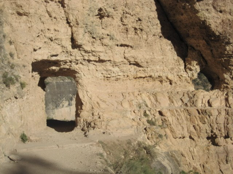
I started down the trail. Relatively close to the top of this one, the map showed two “tunnels”; intriguing! They’re very short, it turned out—maybe they should really be called “glorified archways,” rather than “tunnels,” even—but they were still nifty.
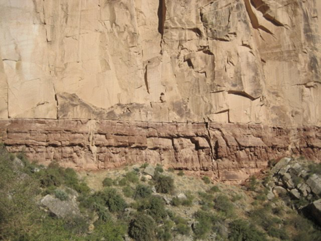
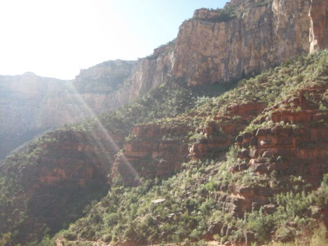
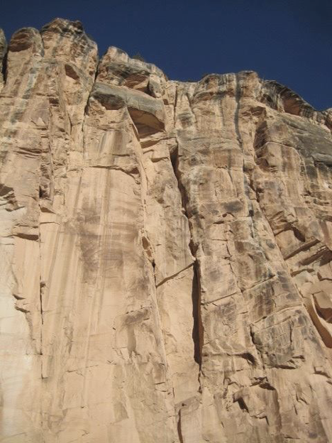
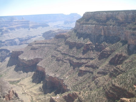
Also, there is a really cool place on the canyon wall where the top (limestone!) layer of rock gives way, in just a bizarrely abrupt and clear and absolute way, to the next, very different layer.
Upon reaching the 1.5-mile rest house, and duly resting there (even though the hike down was actually pretty easy, and I perhaps didn’t absolutely need a rest at this point), I judged that I could afford to continue down a bit farther and still make it up and out by 10:00. So onward I went, though not too terribly much farther. I had no way to know for sure, but I guessed my turn-around point to be perhaps a half-mile past the rest house, for a total hike in of about 2 miles—which had taken me just under an hour and 15 minutes. Incidentally, the elevation drop from the rim to the 1.5-mile rest house is 1120 feet.
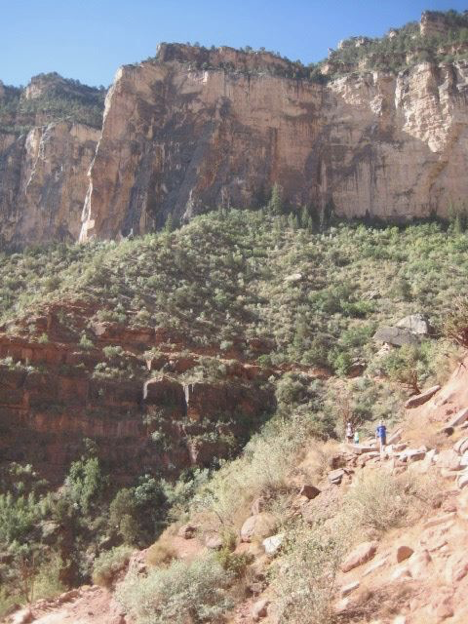
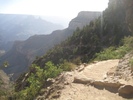
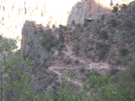
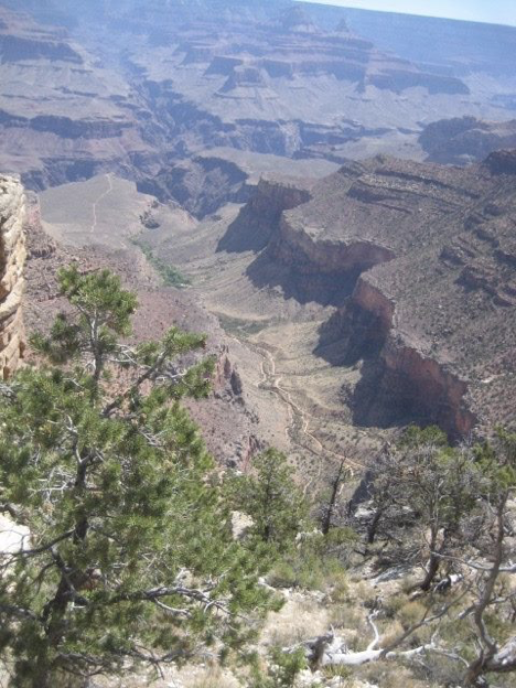
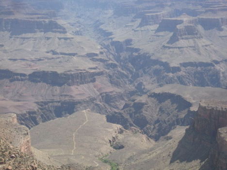
From the point at which I decided to turn around, I had a cool view of the trail as it continued to zigzag its way down the canyon below me. I could even see the 3-mile rest house down below me. Might I get my timing and logistics together such that I could go further tomorrow? I hoped so!
Meanwhile, the haul back up the trail was, once again, tough—though, it seemed to me, not quite as tough as my first such climb, two days previously. Was this trail less steep than the other one? I actually thought so at first, but just now, as I write this, I looked it up, and the elevation drop in that first mile and a half is the same on both trails! So I guess I was just adjusting, or something.
I don’t recall the details of exactly when and how my plan came together for the next day. Maybe it was while I was still on the trail today; maybe not until afterwards, upon my return to the rim, as I perused brochures and signage and whatnot. But what I decided was this: Hiking short distances into the canyon in the morning, then turning around and hiking back out, was well and good, but I wanted more. And, okay, I wasn’t going to be able to get all the way to the river; I’d accepted that. But well before the river, Bright Angel Trail arrives at the bottom of the side canyon through which it descends, and to a place known as “Indian Garden.” It’s a sort of oasis; there are springs, and a creek, and at times of year when rain is actually a thing, other “seeps” emerge too, and as a result of all this, the vegetation is more lush there than either above or below. And there’s a whole day use area down there, as well as campsites and even a ranger station. It’s a 4.5-mile hike from the rim, with a total elevation drop of 3040 feet. I’d have to start basically in the middle of the night if I hoped to hike down to Indian Garden and back up all before 10:00 am. But what if I hiked down in the morning, spent the “heat of the day” resting down there in the shady oasis, and then hiked back up in the late afternoon/evening? This sounded doable, and so it became my plan for tomorrow.
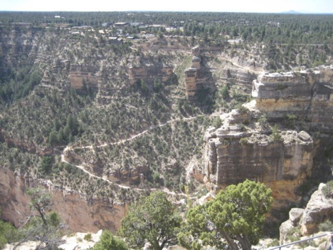
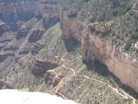
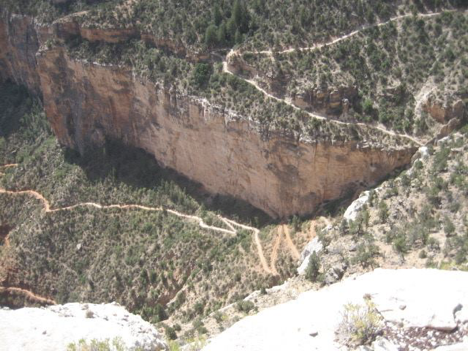
Meanwhile, after my morning’s hike on this day, I took the shuttle bus over to a point that I’d been at the previous day where I had neglected to take good photos. It’s a point from which you have a really good view of Bright Angel Trail heading down into the canyon (called, fittingly enough, “Trail View Overlook”), and I wanted to capture that. See below!
After taking these photos, I went back to my campsite, had lunch, and again basically took it easy for the rest of the day. By this point, I’d basically accepted that this was just sort of the way one does things out here—this time of year, at least. Nevertheless, the evening proved frustrating and unpleasant, in stark contrast to the previous evening. Again, this partly had to do with stuff like food not staying cold in my cooler, and other worries. Also, though, the canister of fuel that I’d bought to use with my rented gas burner for cooking my food ran out about 4 minutes after I started cooking my burgers over it. Arghh! I’d had no idea how big a fuel thingy I would need (lacking relevant experience), so I’d just bought the smallest one. Mistake, apparently. I had to take my partially cooked burgers off the grill, put them in a pan on the floor in the car, pack up all the other food, and drive to the general store to buy anther fuel thingy, then return to the campsite and set everything back up and finish cooking the burgers. Stupid %#!%#@%! non-campfire-based camping!