And so, the day of the big 20-mile hike finally arrived!
Once again recapping some back story here: Way back in 2009, during my first trip to Yellowstone as an adult, Jen and I had explored small portions of both ends of this trail, which crosses the central plateau (more or less in the middle of the park) from one side of the loop road to the other. First, we’d started what ended up being a sort of abortive hike from the western end (which is generally thought of as the “end” of the trail), but due to various circumstances, that hike only ended up lasting a half-hour or so (maybe even less). Then, on a later day, when we were on the other side of the park, we hiked out onto the trail from that end (the “start” as I now think of it). This having been in late June, the trail—and the terrain around it—was extremely marshy, so we ended up spending most of that hike diverging from the trail proper in search of dry ground…and not finding much thereof, and thus getting very wet feet. Five years later, on our 2014 trip, we didn’t spend any time on this trail at all—and yet, I rather think that it was during that trip that I first got it into my head that I really wanted to hike the entire trail someday. There was just something really appealing to me about the idea of hiking across the central plateau, from one part of the park to what felt like a completely different part. Plus, the fact that the trail starts in the Hayden Valley area means that seeing buffalo during the hike seemed likely, and (obviously) buffalo are awesome. But of course, I didn’t know how it would ever happen, given the challenge of how to get back to one’s vehicle after hiking 20 miles one way. Ah, well. And then, of course, during my “solo” trip to Yellowstone in 2016, I had obsessed even more over my wish to someday be able to do this hike. I again hiked a small portion of the trail during that trip, out and back from the trailhead at the northern edge of the Hayden Valley (an increasingly familiar spot), and that trip having been in late July, the ground was dry that time. I did see buffalo, and it was generally an awesome hike, as far as it went. But I still really, really wanted to do the whole trail! So, when the idea of a trip to Yellowstone this year in tandem with the parents and Carl’s family came up, one of my first thoughts was that such a scenario, with other people and multiple vehicles involved, would provide an opportunity (quite unexpectedly!) to scratch this particular itch. Later, when Carl signed himself up to accompany me on the hike, that made it even better. This was really going to happen!
And indeed, happen it did, on this final day of our time at Yellowstone. As planned, Carl and Cassie (and the boys) showed up bright and early at my campsite to pick me up, and we proceeded to the trailhead, which was just a short distance down the loop road from me at Canyon. If I recall correctly, it was 7:21 am when we walked across the road and set off down the trail!
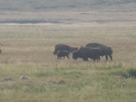
Before long, we—as expected—starting seeing buffalo:
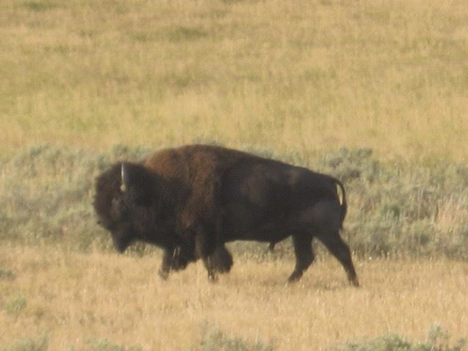
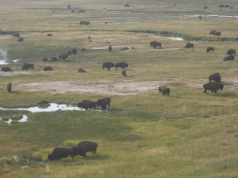
In fact, about an hour and a half into the hike, we caught sight of an entire HERD of buffalo, and before long we were compelled to detour significantly from the trail in an effort to keep our distance. I made several attempts to get a good picture of the herd (or, you know, part of it, anyway); most came out blurry and terrible, but this one isn’t too bad:
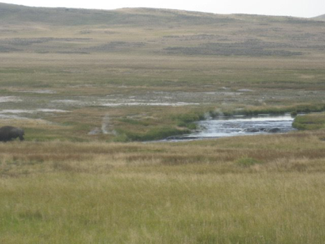
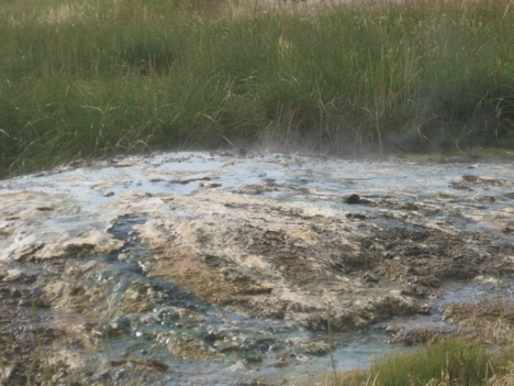
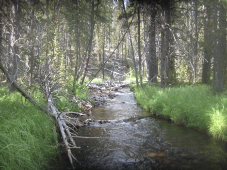
If you look carefully at the picture above, you might notice steam rising from the creek that winds through the scene. That’s Violet Creek, which the map shows as originating from a spot off to the north of the trail called Violet Springs. There was so much steam rising off the creek in so many places, though—accompanied by whiffs of sulfur and areas where the banks showed telltale mineral deposits—that I figured there must be hot springs in the creek bed itself, too. Here are a couple more pictures in which you can (sort of) see what I mean:
As we made our way through this area, things began to feel a bit dicey. More and more buffalo kept coming from somewhere off to the northwest (ahead and to our right), heading toward the main herd clustered to the south (left). In order to keep a safe distance between ourselves and all the buffalo, we had to stay alert and make timely course adjustments. Meanwhile, it was becoming increasingly clear that at some point, we needed to cross Violet Creek. It was narrow in some places, and (as you can see in the pictures above) there were spots where one could probably get across by stepping on rocks, which was good; given both the thermal features and the buffalo situation, pausing to change footwear and then wading across would not have been the thing to do. But we still had to find a place where we could get across while keeping our distance from buffalo, and there came a moment when an approaching cluster of them threatened to force us into the creek whether we were at a good spot or not! Luckily, though, we ended up being able to get across where we needed to.
As much fun as hiking with the buffalo was, by this time we were quite eager to find the trail again—not least because detouring off of it was adding time to what was already going to be a long hike. So, once we were finally safely away from both the herd and the path that the stragglers were taking to join up with it, we veered southward and eventually made our way back to the trail. But shortly thereafter, the trail started abandoning US every so often. It was very confusing. The first time, we were walking along what very clearly appeared to be the trail when we saw a trail marker on some trees some ways off to our left. Carl had actually brought a GPS device with him, which I ended up being very grateful for (I came to realize that I may well have gotten very lost had I been on my own and without the GPS), and as we proceeded along the “trail,” the GPS started indicating that we were actually off to the north (right) of it. And then, a little farther on, the trail petered out. Backtracking around the clump of trees where we’d seen the trail marker, we eventually found the trail again—but it was at least as far south of the marker as the apparent trail that we’d initially followed had been north of it. And as for where it had diverged from the trail-looking thing that we had followed, we had no idea! Oh, well. Onward…until, some while later, we once again found the trail petering out on us, and Carl got out the GPS again, and this time it showed that we had strayed well south of the trail! The GPS also showed that the trail itself was going to jag somewhat southward up ahead, so we figured that by angling just moderately to our right, we ought to rejoin it in due course. Unfortunately, though, it turned out that even though the landscape in this area was mostly flattish open meadows, there was a slice of much more difficult terrain between us and the trail. We huffed and puffed up an incline, only to find that the ground dropped sharply away into a wooded ravine with a lot of downed trees and debris on the other side, forcing us to backtrack. Argh.
After this experience, we learned to watch vigilantly for trail markers, and to consult the GPS right away if ever it started seeming like we hadn’t seen one for a while. That last detour had been physically taxing and a bit dispiriting, and had, we figured, probably set us back a bit timewise (whereas up to then, we’d been making very good time). As we pressed onward, though, we came to a point where the open terrain ended, and the trail plunged into a forest of lodgepole pine. Here, at least, there seemed to be much less danger of the trail becoming difficult to follow. Memory is failing me a little here, but I THINK we stopped to rest for the first time just past where the trail entered the trees. It was not too much later, though, I think, when we came upon Mary Lake, where we (also?) stopped briefly. I had to wade into the lake, of course (whose water, again, proved surprisingly not-cold), and a picture needed to be taken.
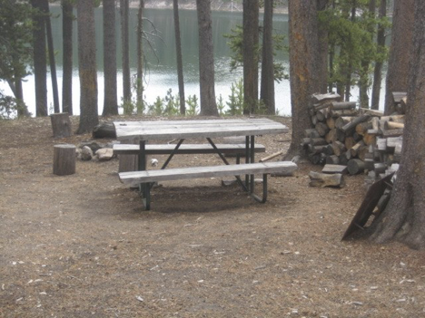
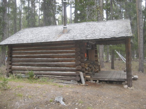
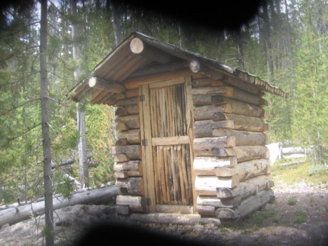
Maps and trail books indicated that there was some sort of “patrol cabin” located by the lake. We were envisioning an old, disused structure from early in the park’s history, or something, but it turned out to be very well-maintained and clearly in regular use (by park rangers, I suppose). It was just a short ways down the trail past the point where it first approached the lake. It’s also listed in my trail book as being at the 10-mile mark…so we were already halfway through our hike! The picnic table next to the cabin seemed like an obvious spot to have lunch, so that’s what we did.
After lunch, we made a mistake. Lulled by the ease of following this woodsier part of the trail, and caught off guard by the unexpectedly civilized lunch spot that we’d found, we set off along what we thought was the trail, but actually…wasn’t. We should have known, too; the not-trail climbed a hill heading somewhat away from the lake, which wasn’t our expectation for what the actual trail was going to do. (Looking at my hiking book now, I see that it mentions an “abandoned trail from Cygnet Lakes” in this vicinity; I wonder if we were on part of that?) Anyway, having forgotten about watching for trail markers, we were dismayed a while later when our “trail” again petered out, leaving us in a trailess wooded area with a bit of a drop-off to our left (toward the lake). GPS said that the trail was that way, though, so we made our way down the incline (which was much more passable than the earlier one that had forced us to backtrack) and through the scrub and fallen trees until we located it. Cursing ourselves for having gotten lax and let ourselves be fooled again, we went back to watching carefully for trail markers, and this did end up being the last time that we strayed from the trail.
We hiked onward through alternating stretches of woods and more open areas for a couple hours. Speaking for myself, I was still having fun, but also feeling increasingly tired and sore, and glad that we were past the halfway point and making good time. And in due course, we came to a creek that had to be forded. Woo-hoo! I think this must have been Magpie Creek. The map also shows a Cowan Creek crossing the trail (well before Magpie), but that one must have been narrow enough to hop across on rocks or fallen tress or something; based on the time stamps on my pictures, the one that we actually waded across (and dunked our heads into) really could only have been Magpie.
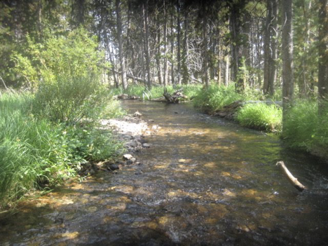
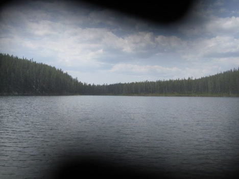
We had only an approximate notion of our progress at the time, of course, but as it turned out, we were about two hours from reaching the end of the trail as we set off again on the far side of the creek. Nez Perce Creek flowed alongside the trail for the remainder of the hike from here, off to our left (most of the way). For, as far as I can remember, no special reason, I took a picture of it about an hour after fording Magpie Creek.
Somewhat counter to my expectations, we also started seeing the occasional buffalo again during this final stretch of the hike. In the past, I’ve often wondered at seeing buffalo pies and other signs of them in heavily wooded areas, since I’d never really seen an actual buffalo in such an area—but we saw at least two isolated ones hanging out among the trees this afternoon. One of them was on the trail ahead of us when we first spotted him. Fortunately, he was walking along the trail in the same direction that we were, because there wasn’t much space to either side for us to go around him if we’d needed to. Instead, we just took it slow, catching glimpses of him off ahead as we would go around bends in the trail, trying to stay well behind him. Eventually he left the trail.
Nez Perce Creek eventually crosses the trail (or does the trail cross it?), about two miles before the end. In my hiking book, it says that “you have to ford” the creek, and even adds “sorry, no bridge.” What we discovered, however, is that this is a lie…or, just possibly, a harsh (but not altogether unwarranted) judgement regarding the structure that spans the creek?
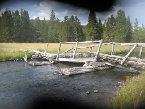
The laughable mess is clearly very old (and its having been there for decades was confirmed for us by some people we encountered on the far bank after crossing it), so it’s not that my book is just out of date. So, the “sorry, no bridge” remark is a mystery—unless, indeed, it really was meant sarcastically!
However that may be, the fact of encountering other people here was a sure sign that we were nearing the end of our hike; these folks, of course, had just hiked out the two miles from the “ending” trailhead to get here. During this most final of final stretches, I kept looking for the terrain to sync up with my memory of the short hike from the trailhead at this end that I did with Jen nine years ago, but oddly it never really did. I’m sure my memory is 100% accurate, and the trail itself radically changed in the intervening years. 🙂 We passed by some back-country thermal features, keeping an eye on the buffalo that was meandering in the same general direction as we were off away from the trail a ways in case he should decide to approach any closer, and started scanning ahead for signs of the loop road (we were pretty darn worn out by this point). And, sure enough, pretty soon we were catching glimpses of cars going by, off ahead, through gaps in the clusters of trees nearer the road. We dragged ourselves across the final half-mile or so, and voila! There was the trailhead, and the road, and (most importantly) MY CAR, right where we had left it the previous evening, about 25 hours ago. We made note of the exact time of our arrival at the trailhead, but I didn’t record it anywhere and don’t remember it now. I do remember, though, that was just a few minutes short of the 10 1/2 hour mark—so, I guess, shortly before 5:50 pm. Twenty miles in ten and a half hours! My prediction had been that it might take us about eleven hours (averaging 2 miles per hour, with an extra hour added in for lunch & other breaks), so we did a little better than anticipated—and had tons of fun doing it. A highly successful endeavor!
We collapsed into the car, blasted the A/C, and hit the road. Pretty much every part of me hurt at this point, and I was physically exhausted. Unfortunately, though, I still had a not-insignificant amount of driving ahead of me before I could really relax; I had to drive all the way around to Fishing Bridge, drop Carl off, and then head back up to Canyon from there. We were out of water and very thirsty, so we stopped at Canyon en route. Carl hobbled into the general store to buy himself something, and I limped into the visitor center to slurp down about a gallon of water and fill my bottle. We both found, upon getting out of the car and back on our feet, that we could barely walk. Totally worth it, though!
When I finally got back to my campsite after dropping Carl off, I continued pushing through the pain long enough to settle in and get a fire going and food cooking and stuff, then (at last) collapsed again into my camping chair to eat supper and veg out. Ahhhhhhh. It had rained while we were driving back around the loop road after the hike, and my chair was a bit wet, but I was too tired and sore to care. I’d done it! Hiked the entire Mary Mt. Trail!