I had spent quite a bit of time pouring over my book of hiking trails trying to decide how to spend my last day in the park. I wanted to get in some serious hiking, preferably somewhere that I had not hiked before—and I was still sort of thinking that trails that required fording streams sounded like fun. Also, I didn’t want to kill too much time driving, so I hoped to find a trail or two that weren’t located in too remote an area of the park from my Bridge Bay home base. A couple of the options that looked the most appealing to me got ruled out due to this final criterion (but will still be there if/when I get back to Yellowstone again in the future!), and I eventually decided to start off, at least, with the Ice Lake trail—a 4.5-mile loop with the trailhead being located on the road between the canyon and Norris areas (i.e., the east/west road forming the middle section of the figure 8). The trail crosses the Gibbon River twice (my book said that the river is more of a creek and the fords are easy) and also goes by a waterfall, so that sounded pretty cool, even if I might have preferred a somewhat longer trail.
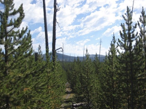
My expectation that the trail would be cool-but-short was quickly confirmed once I got there and started hiking. It went through an area of young-growth lodgepole pine that had sprung up since the big fires of 1988, which I found agreeable—but I came to the lake pretty quickly, and judging by the rate at which I began making my way around it, it seemed clear that this hike was not going to occupy my entire morning. At what would have been about the halfway point, I came to the first “ford”—but found it more a case of the sort of “adventure” that I have shared with certain nephews on past camping trips in MN (walking on downed trees/logs across a narrow and shallow creek) than a genuine stream-fording experience. I mean, sure, I could have changed into water shoes and walked through the water…but it didn’t really seem worth it. Oh, well.
Across the river, the trail headed away from the lake a bit, then came to a fork; my Ice Lake loop trail continued in one direction (looping back toward/around the lake and then to an end point on the road just down from where I’d started), and a longer one-way trail called “Chain of Lakes” (because it led to/past three other lakes) went the other way. Suddenly unclear as to why I hadn’t planned on this from the start, it occurred to me now that I could extend my hike by heading the “wrong” way here; I’d have to hike out a ways and turn turn back, of course, so that I could then complete the original loop and end up back at my car, but that was fine with me. Thus, my little 4.5-mile hike ended up turning into a hike of (I think) a little over 10 miles, and taking almost four hours.
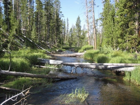
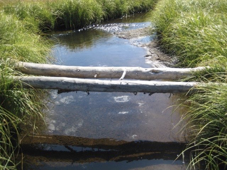
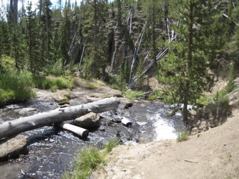
Before arriving at the next lake, the trail crossed the Gibbon River again—but once again, there were downed trees lying across it so that wading across was not actually necessary. Nevertheless, this time I did wade across, just for the heck of it. In mid-stream, I stopped to take a picture of the non-wading route across that I was notably not using:
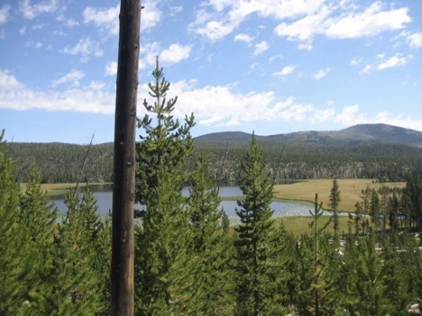
A bit later, the next lake—Wolf Lake—came into view. My trail was supposed to cross the river two more times in this vicinity, as it emptied into and then continued out of the lake (or the other way around, actually, as I would come to the outlet first).
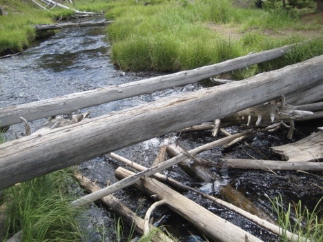
Though it was extremely shallow (ankle-deep or so), I genuinely did have to wade across the river as it made its way out of the lake.
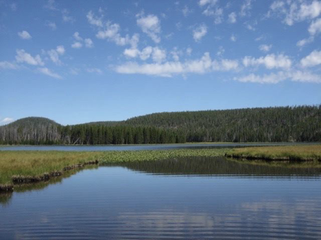
Going into the lake, on the other hand, wading was not necessary—but since I didn’t know this in advance, I kept my water shoes on after the crossing at the spot depicted above, for the short walk across a grassy field to the next crossing:
Just before coming to the spot depicted above, I encountered another hiker coming from the direction in which I was heading. He mentioned that he had seen fresh bear droppings on the trail just over the next little rise. “Ooh!” I thought. “Finally—this could be my chance to get eaten by a bear!” This was the final stretch that I planned to hike before turning back, and it led to yet another lake: Grebe Lake. Like Wrangler Lake from my (abortive) hike on Wednesday, this one was described as a major mosquito breeding ground, so I wasn’t sure just how close to it I actually wanted to get—but I figured that if things started getting really mosquito-y, I could always turn back early. As I approached the lake, I did start to notice increased mosquito activity, but although it was enough to prompt me to dig my repellent out of my backpack and apply it, it wasn’t super-awful or anything. Even so, I went just far enough to be able to see the lake (but apparently failed to take a picture of it) and then turned around, eager to leave the mosquitos behind.
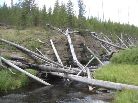
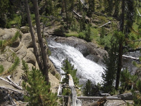
The hike back the way I’d come, past Wolf Lake and eventually rejoining my original Ice Lake Loop, seemed to take quite a bit longer than the hike out had, but I still enjoyed it. I didn’t take any pictures (or mention it above), but there were these two weird spots on this part of the trail where the ordinary dirt-colored earth gave way very abruptly to dirt that was a vivid, rich brownish-red color for just a few feet, and then went back to normal. Anyway, I eventually got back to the junction and embarked on the remaining part of my loop—which soon brought me to yet another spot where I had to cross the Gibbon River. Once again, it was a not-at-all-difficult crossing:
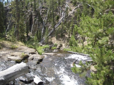
This stretch of the river was picturesque, though, and just a short distance past the crossing, I came to the falls.
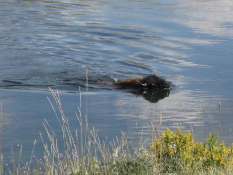
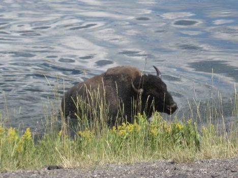
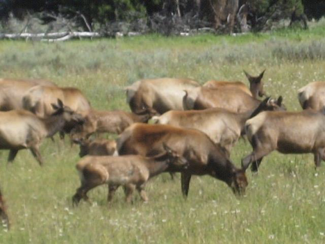
From here, it wasn’t too much farther until the trail ended, at a spot just down the road from where I had started. I walked along the road to the trailhead, tired and hungry, and then drove to a nearby picnic area to eat my last lunch in the park. My only remaining plan for the day was to hike a short trail whose trailhead was actually located in the parking lot of the marina at Bridge Bay—so, right at my home base. Thus, after lunch, I actually headed back to the campground. Along the way, there were some nifty wildlife sightings in (where else?) the Hayden Valley.
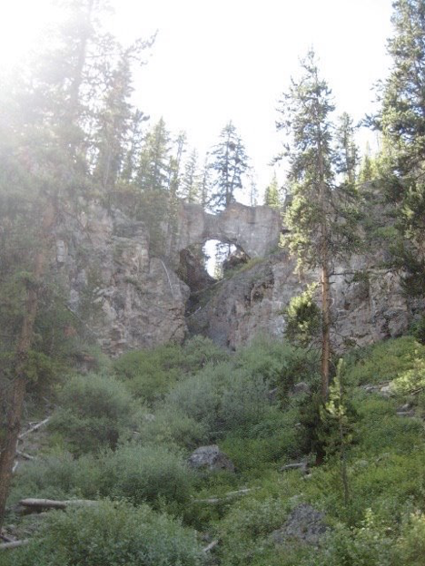
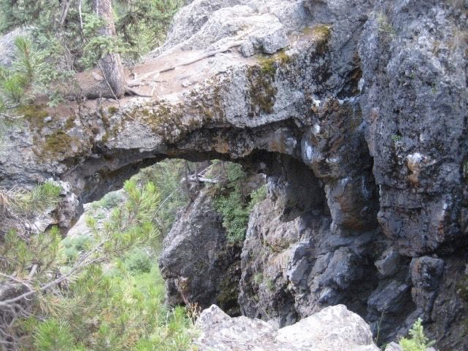
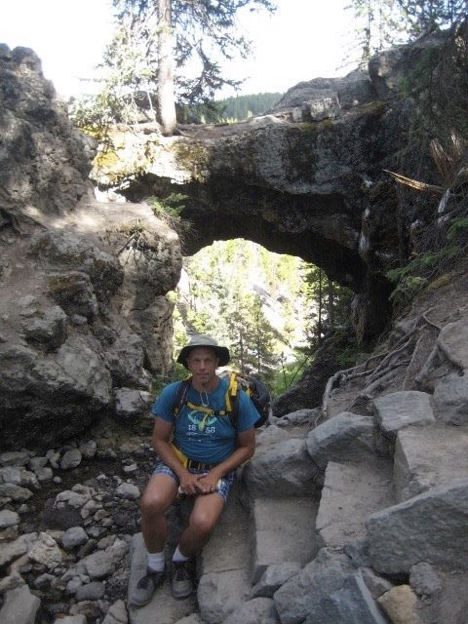
The trail back at Bridge Bay that I was interested in was pretty short; I don’t have my book with me at the moment, but I think it was only a couple miles out and back. Also, part of the “trail” was actually an old road that is no longer used by vehicles—so, not exactly the height of back-country wilderness (and indeed, a number of families with young children were out on the trail—probably all people who, like me, were staying at the campground). The point of the trail was the nifty rock formation at its end—a “Natural Bridge” (that’s what both it and the trail to it are called) that was carved through some rock by a stream that looked way, way too small to have done anything of the sort (though I suppose that at other times of the year, the stream probably looks different).
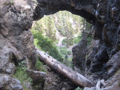
Almost everyone else who was on this trail while I was seemed to be stopping roughly where I was standing when I took this picture, and then turning back. However, the trail did continue, winding steeply up and around to a point where one could walk out onto the Natural Bridge (though a bunch of signs forbade doing so, for the sake of preserving it), and then passing immediately behind it (across the tiny stream) and down and around the other side.
That’s about it, then! I followed the trail down and around the other side of the Natural Bridge, back to where it rejoined the main trail out and back, retraced my steps back along that trail to the parking lot, and then drove into the campground proper and back to my site for the evening/night. One final campfire-cooked dinner, one final ranger presentation in the campground’s amphitheater (all about wolves in the park—which had been hunted to extinction in the 1800s, but were reintroduced in the 1990s; very interesting), and some cleanup and preparation for packing up to leave in the morning, and then I settled into my tent for my final night in Yellowstone.