My plans for this day consisted, for the most part, of finishing up and/or trying again at the things that I’d set out to do the previous day: I wanted to get (via car, obviously) to the Brink of the Lower Falls and perhaps some of the other scenic spots along the north rim trail that the trail closure had prevented me from reaching on foot, and I still really wanted to do some hiking in buffalo country. If I accomplished these things, I also had a mind to check out the mudpots in the “Mud Volcano” area, since I was driving right past it every time I went between Bridge Bay and the canyon area.
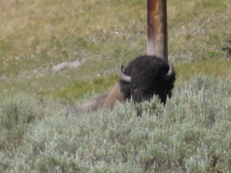
On my way through the Hayden Valley en route to the canyon area in the morning, I finally saw some buffalo closer up (couldn’t believe it had taken this long!).
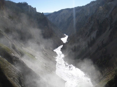
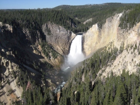
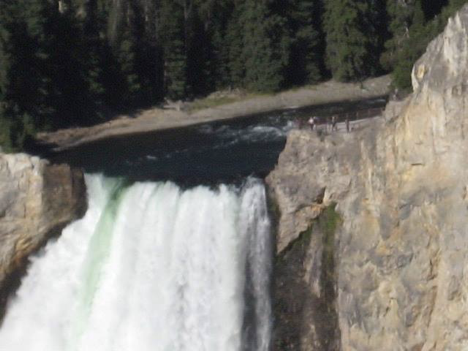
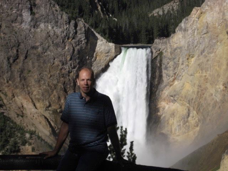
When I reached my first destination and made my way down the trail to the Brink of the Lower Falls, I had the same reaction that I’ve had every other time I’ve been there: just stunned at how amazing it is. Pictures never quite do it justice, and even though I remember feeling this way every time I’ve been there, it still overwhelms me every time. Plus, this particular time was somewhat unique since I was there first thing in the morning—and as a result, I was the only person there. I stood there looking at the falls, and the canyon below, and thinking to myself: “Every day of my life, no matter where I am and what I’m doing, this is here and happening.” It’s mind-boggling to think of the river rushing dramatically over those falls 24 hours a day, 365 days a year. I made a mental note to think about the fact that this exists, and to remember the feelings that standing in this spot inspired, at times when I’m feeling stressed or discouraged, or when things in my life seem disappointing and mundane.
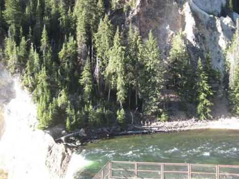
After the Brink, I stopped at one more canyon spot, called “Lookout Point” on maps. There were actually two separate “spots” there, though—a short trail leading to a high overlook point, and a longer trail descending down to another point with a good view of the lower falls.
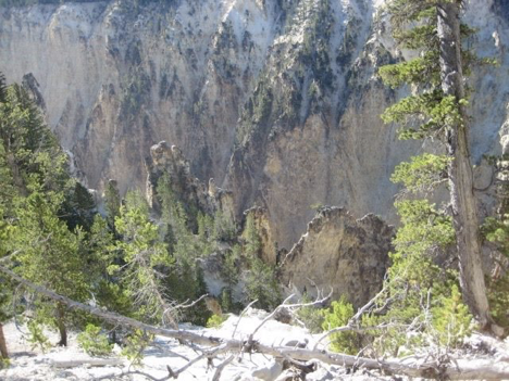
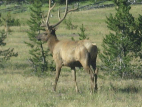
There were more scenic viewpoints that could be visited, and the canyon and falls are not things of which one grows tired easily, but I didn’t want to spend my whole morning at this—so I decided to move on to the next thing at this point, which meant heading back down the road to the Hayden Valley area. At the Canyon Village junction, though, while turning out onto the main road to head south toward the valley, I saw this right by the side of the road:
For my hoping-to-see-buffalo hike, I chose a trail called Wrangler Lake. It began at the Wapiti Lake Trailhead—just across the Chittenden bridge from the main road, and the same place where I had parked the previous day while exploring the north rim & south rim trails along the canyon. It was supposed to be just over 10 miles “out and back,” leading through a “wildlife-rich area,” and it would also require fording a couple of potentially waist-deep and swift-moving creeks—which sounded like adventurous fun to me! The only unappealing thing in the description of the trail, really, was the destination, which was supposed to be a “mosquito-breeding haven.” But I figured that if things started getting really mosquito-y as I approached the lake, I could always turn back early; plus, I did, after all, have insect repellent with me.
Setting off on the trail, I immediately liked it; I saw no buffalo in the immediate area, but it did look very much like buffalo habitat—especially off to the right/south of the first segment of the trail, which was encouraging since I knew that the trail I planned to take was supposed to branch off from the starting trail and head in that direction. So, it was a beautiful day, and there I was hiking along and reflecting on how utterly content I was feeling, while at the same time eagerly anticipating what later portions of the hike had in store for me…when I got to that junction where my trail split off to the right, and encountered a sign declaring that that trail was closed from here onward (something about wildlife protection, I think). Argh!
I could keep going straight ahead instead of taking my intended trail, but that was a much, much longer route, parts of which were described in my book as being not the greatest trail, and other parts of which were part of a (really cool) loop hike that Jen and I had done the last time we’d been to Yellowstone. The main alternative that I was considering was turning around, retracing my steps back to where I’d parked, and driving the very short distance down to yet another trail that Jen and I had hiked parts of before (alas, trails in the Hayden Valley area that I had not hiked at least some portion of before were few—and I really wanted to hike with the buffaloes, but without driving clear up to their other main stomping grounds in the Lamar Valley). This other option was the Mary Mountain (or Alum Creek) Trail, and I ended up settling on it as my choice.
If you’re at all familiar with Yellowstone, then you’ll know that the main roads in the park form two large loops (or, taken together, a sort of figure 8), with the “lower” (southern) loop being more or less in the center of the park, and almost entirely within the caldera formed by the last eruption of the volcano underneath the place. (Every time that I’ve referred to the “main road” in my writings thus far, I’ve been talking about some portion of this central loop.) The large area within the loop is labeled on maps as the “central plateau,” and the Mary Mountain Trail goes all the way across this region, from one side of the loop to the other. Ever since becoming aware of this trail on our first Yellowstone trip seven years ago, it has intrigued me. I’d really love to hike the entire trail someday, but there’s a big problem: it’s a twenty-mile hike across the loop, one way. I could handle the 20 miles (bringing lunch and making it my whole day), but what to do when you get to the end? You’d need either to have someone come pick you up and drive you back around the loop to where you started, or (even better) to leave your vehicle at the end point before the hike and have someone drive you to and drop you off at the starting point. Since there isn’t, you know, a taxi service that operates in the park, the logistics of this are very difficult.
Obviously, I wasn’t going to solve this problem today. But why not at least hike a section of the trail, then turn around and retrace my steps to the starting trailhead? It was close by, and I’d almost certainly see buffalo. My hiking book even has a separate entry for just the first section of the trail at the Hayden Valley end, calling it “Alum Creek” and explaining that many hikers do just this portion, out and back, in order “to avoid the problematic shuttling of vehicles.” Check. Seven years ago, Jen and I had set out on this very hike, but the terrain had been so swampy that we spent the whole time either trying (not very successfully) to find dry ground to walk on near the trail or trying, after each digression from the trail in search of dry ground, to find the actual trail again, since it was nothing more than a trampled line through the meadow heading along the edge of the open prairie, with the treeline a short ways off to the right. We had made very little progress along the trail because of all the digressions, had ended up with soaked shoes, and (if memory serves) had ultimately turned around due to a combination of the ground just getting more and more marshy, and the beginnings of a rain that had looked and sounded likely to become an all-out thunderstorm. (Earlier on that same trip, we’d also started a hike at the other end of the trail, over on the other side of the loop, but had turned around sooner than we’d planned on that one as well for various reasons.)
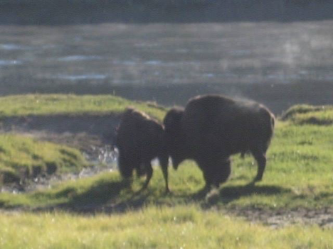
Anyway, with it being later in the season this time and the weather not being very rainy at all I had high hopes that the ground would by drier this time around on the Hayden Valley end. So, after hiking back to my car from where I stopped on the Wrangler Lake Trail, I drove down to the Mary Mountain trailhead—just a short ways south of the canyon area, at the northern edge of the Hayden Valley. From the trailhead, I could see buffalo near the road to the south, and cars parked in turnouts so that their occupants could gawk at them. This was a good sign! I set off down the trail, and as soon as I got up to the top of the first little rise, I saw more buffalo ahead of me, on or near the trail. I was also pleased to find the ground dry but for the occasional muddy spot where little trickles coming down through the prairie grass from the wooded ridge to the north crossed the trail. These spots were easy to step or jump over, though, so all was well. I soon found, however, that I still had to digress from the trail almost as often as Jen and I had done the other time—in this instance, in order to make nice, wide, safe arcs around a series of buffaloes!
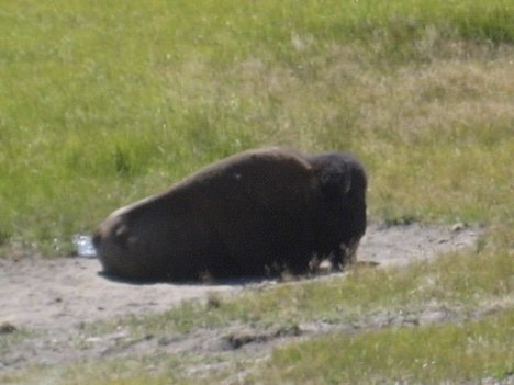
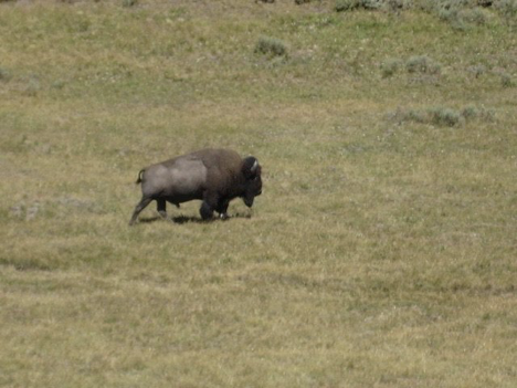
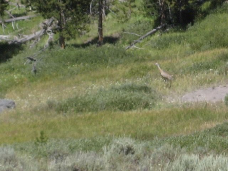
Okay, I exaggerate; I only had to leave the trail perhaps four times because of buffalo (before turning around, that is), and it was always easy to find again after each digression this time. This was actually a pretty great hike, with my only regret being that I had to turn back much sooner than I would have liked (especially considering that what I would really like to do, as I mentioned earlier, is hike all the way across the central plateau…). I could have gone somewhat farther than I did if I hadn’t spent part of the morning on my abortive Wrangler Lake Trail hike first, but as it was, the time came when I knew I needed to turn around if I hoped to have lunch at any kind of reasonable hour. Before getting to that point, though, I did encounter one other interesting thing. Actually, it initially really startled me! There was a loud bird call from somewhere quite near me, sounding a little bit like a higher-pitched-than-normal loon call, if the loon had a really scratchy voice. This was answered by another, similar call from somewhere much further away, which kind of echoed a bit off the ridge of somewhat higher ground off to my right. This back-and-forth was repeated a few times, and I stopped walking and scanned the area to try to see where the nearby calls were coming from. Eventually, I spotted this bird:
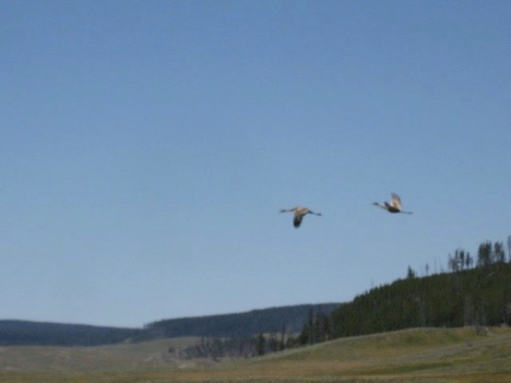
A moment after I snapped this picture, the bird—along with another one that I hadn’t spotted—took to the air and flew off in the direction from which the farther-off calls had been coming. I still had my camera in my hands, so I was able to catch them in flight:
On the return trip back to the trailhead, I crossed paths with a sizable party heading out on horseback. I also again had to make off-trail arcs around a few of the same buffaloes that I had seen on the way out, though at least one of them seemed to have moved off elsewhere by this time. And finally, I almost lost my watch on this part of the hike. At a certain point, I glanced at my wrist to see how late it was getting, and found no watch there. Thinking back, I remembered stopping a ways back to drink some water, and I remembered how every time I put my backpack on, I tended to have trouble with my watchband catching on the backpack strap. So, I reasoned that after my water stop, the band had probably caught on the strap and been pulled apart, causing the watch to fall off without my noticing. Dismayed, I retraced my steps a ways, scanning the ground for the missing watch. When I had gone far enough that it was starting to feel like I was probably past the spot where I’d stopped for water, and I still hadn’t found it, I started to despair…but I decided to keep going back just a little bit farther, and—sure enough—about thirty seconds later, I came upon it, lying on the trail in plain sight. Whew! (Unfortunately, the tiny metal pin that holds the strap onto the watch itself was nowhere to be found, so for the rest of the trip I had to settle for keeping the watch in my pocket.)
After getting back to the car, I headed south through the valley, intending to stop at the first picnic area that I came to and eat my lunch, and then proceed on down the road to the Mud Volcano and Sulfur Cauldron area. And that’s exactly what I did, though it took me much longer to get through the valley than I’d anticipated, due to the enormous herd of buffalo that was explaining to the heavy traffic on the road that this was, in fact, buffalo territory, not people territory, and they could therefore block the road as much as they pleased, and the people would just have to wait patiently until they were finished here. (In order not to hold up traffic even more, I refrained from stopping to take pictures once I finally made my way to where the buffaloes were actually in the road—a degree of restraint and consideration, incidentally, that not many other drivers displayed.)
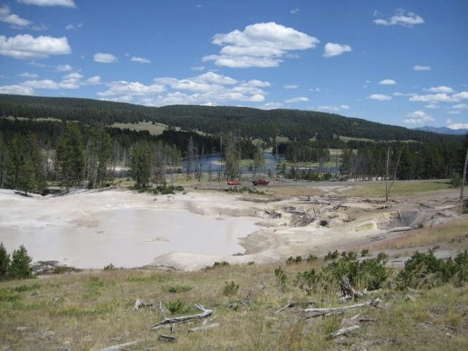
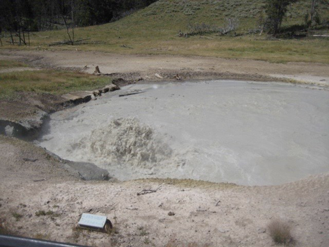
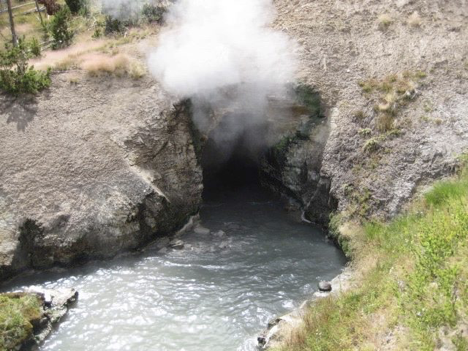
As for the mudpots: The thing about them is that they’re weird and fascinating…but on the whole, they really don’t photograph well. Perhaps for this reason, even though I’d seen them before (both seven years ago and also 28 years ago), I didn’t have very vivid images of them in my memory. Actually, one of the most interesting things about the Mud Volcano area is how changeable it is; many of the mudpots have signs describing how x number of years ago they looked one way, but then mysterious subterranean events caused dramatic changes, and then subsequent subterranean events caused additional changes, etc. Most fascinating of all is the “Cooking Hillside.” Now, it’s a stretch of sloping ground with a bunch of dead, downed lodgepole pines lying on it. Interpretive signs explain that when the boardwalks through the Mud Volcano area were built, this hillside was densely forested—until (I think) 1978, when underground geothermal activity dramatically raised the soil temperature on the hillside, cooking the roots of and thereby killing all the trees. This happened just a few feet from where you stand on the boardwalk to read the sign…!
After touring the mud volcano boardwalk (which didn’t take long), I decided to call it quits for the day even though it was still only mid-afternoon; there wasn’t enough time for any major hiking or to go anywhere very far away, and besides, I had kind of had it with driving after the long wait in the buffalo-related traffic jam before lunch. Thus, I got back to my campsite earlier today than on any other day during the trip. Today was also the day when, as I alluded to earlier, it started to rain shortly after I put my dinner on the grill over my campfire. Since I had gotten back so early, I’d figured that today was the day to go to the effort of making kabobs, rather than just throwing burgers or brats onto the grill. Well…let’s just say they ended up a bit undercooked, what with the rain and all. They were still edible, though, even if not quite as delicious as they might otherwise have been.
The rain stopped while I was eating, but with everything being wet and me being a bit tired, I ended up snuggling into my tent and reading for a good chunk of the evening. I’d planned to go to the evening ranger presentation at the campground’s amphitheater, but when the time came, the tent was feeling awfully dry and comfy, and I was really into my book—so I skipped it. (I haven’t mentioned this, but I did go to the ranger talks the previous two nights. The one happening on this day sounded really interesting, too, although I can’t remember what the topic was now. Oh, well.)